Indonesia · Island occurrence guide

Tidore

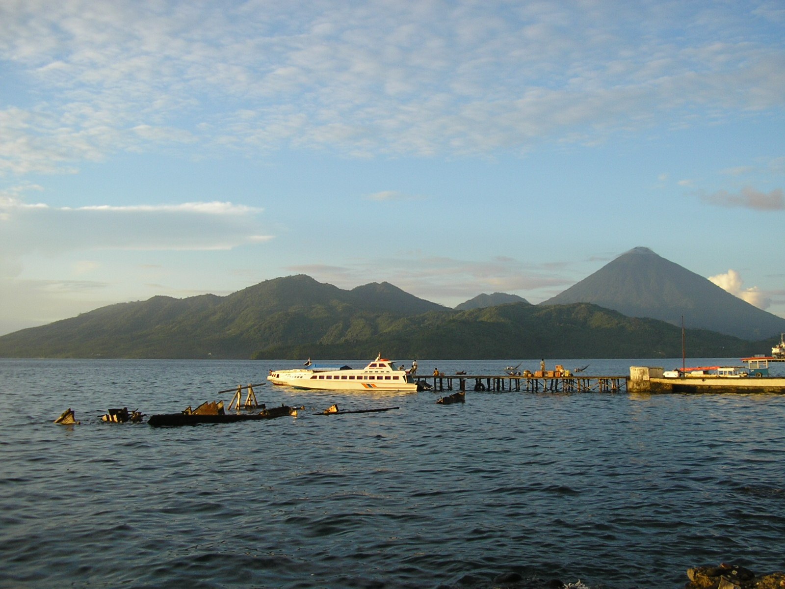
Tidore rises into the symmetrical cone of Kie Matubu, with an older caldera landscape in the north. Coastal villages and gardens occupy the narrow margin between the mountain slopes and surrounding straits.

Tidore Island, viewed across the water from Ternate.
Tidore Island, viewed across the water from Ternate.Image: Achmad Rabin Taim · Source · CC BY 2.0. Resized for display; image content and framing retained.

Geography & landscape

A sense of Tidore.

The island lies west of Halmahera and immediately south of Ternate. Soasio and the port of Goto occupy its eastern side. Mare lies offshore to the south and Maitara toward the northwest. The larger municipality also reaches onto Halmahera; the island itself is the focus here.

Geographic unit
Island
Setting
North Maluku, south of Ternate
Loading the geographic map…

Drag to explore. Use + / − or pinch to zoom. Terrain shows relief and contours; Street map shows detailed coastlines, settlements and roads. Markers locate islands, not snake sightings.

Open larger map

How the land took shape

Geology & relief.

Kie Matubu dominates southern Tidore, while Sabale caldera and smaller cones occupy the north. Smithsonian mapping identifies this as a volcanic island with several distinct structures. Research into ancient ash deposits records a longer eruption history than the short period of European written observations reveals.

Across the seasons

Climate & vegetation.

The island sits in the humid equatorial environment of northern Maluku. Its volcanic relief places elevated slopes above a warm coastal belt. Gardens and settlement follow accessible lower ground, while higher slopes experience different exposure and temperatures.

Connections & isolation

Biogeographic setting.

Tidore is part of the northern Maluku rainforest setting, close to Ternate yet separated by seawater. Its strongly elevated terrain provides environmental variation within a small area. Long-standing cultivation means that present vegetation includes human-managed tree cover as well as less modified upland land.
Tidore · Environments

Habitats of Tidore.

Explore the environments described for Tidore. Habitat descriptions do not assign every snake in the island list to each setting.

Mountain slopes

Kie Matubu’s steep flanks form the island’s principal terrestrial gradient, rising well above the surrounding coastal settlements.

Cultivated lower land

Tidore’s spice-growing history is reflected in managed vegetation around inhabited lower slopes.

Coastal margins

The eastern harbour frontage and shores facing Ternate belong to a compact system of channels and small neighbouring islands.

Read the habitat guide

Around Tidore

Places in the landscape.

Kie Matubu

The southern cone is the island’s dominant landmark.

Sabale caldera

The northern volcanic depression adds a second major landform.

Soasio

The eastern town overlooks the water toward Halmahera.

Read the original scope

Behind the occurrence.

Choose an account recorded in Tidore. Its country-level evidence retains the named islands and qualifications; it is not a record of a sighting at an exact map point.

The shared collection

Snakes recorded here.

Each card opens the same species account used by the country lists. A shared island record does not imply occurrence in all countries sharing that island.

Further reading · Checked 7 October 2026

Geographic sources.

Species-specific distribution evidence appears above and in each linked account.