Island atlas · Landscapes & species
Babuyan
2 species records name Babuyan. Explore their natural history, taxonomic history and distribution sources.
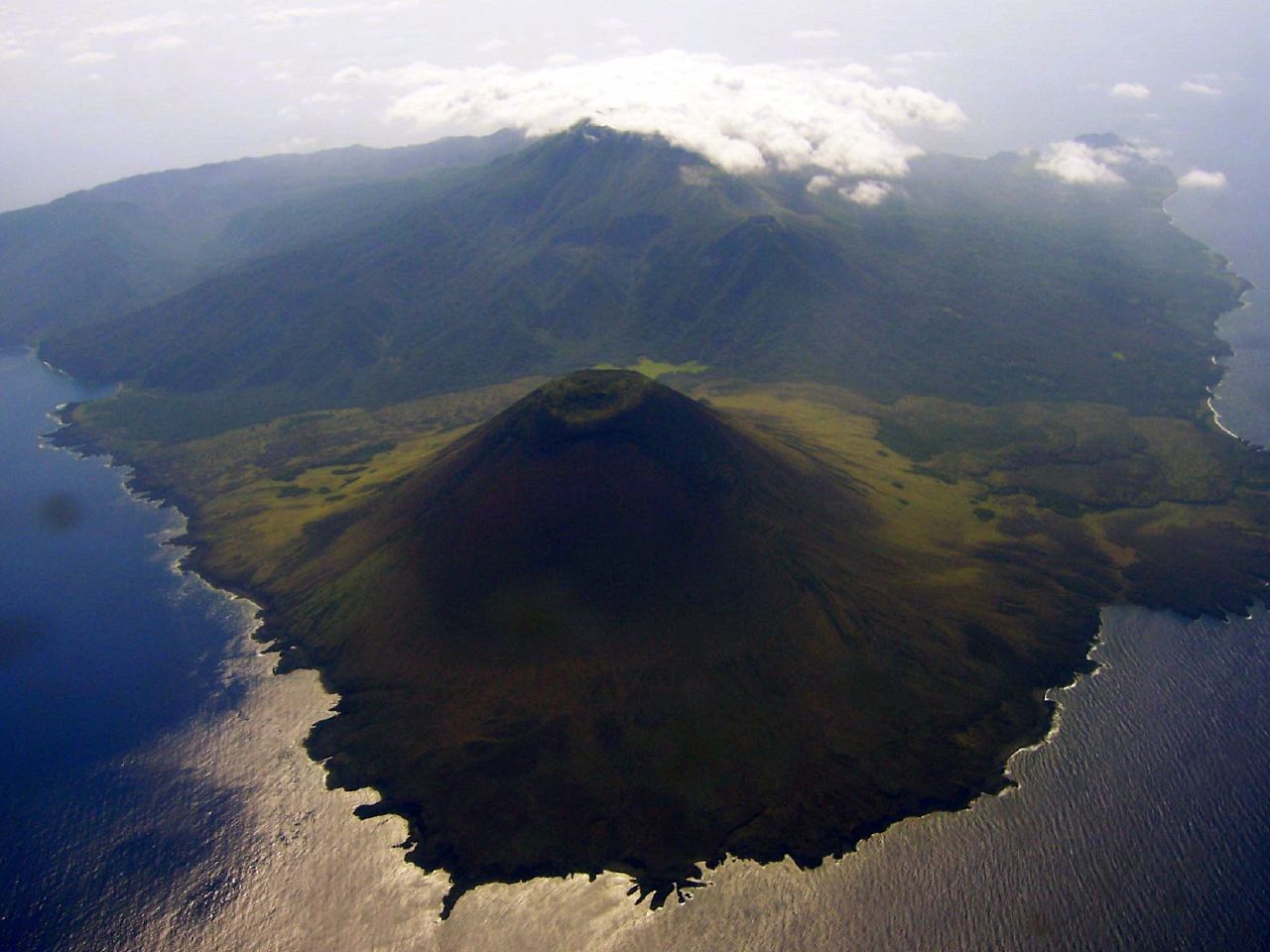
Smith Volcano on Babuyan Claro, one of the islands in the Babuyan group.
Photo: Bing Ramos · Original photograph · CC BY 2.0. Displayed to fit the frame.
Beyond the species list
A sense of place.
The Babuyan Islands sit between northern Luzon and Batanes. The Babuyan Channel separates the group from Luzon, while the Balintang Channel lies to its north. Its major islands are Babuyan Claro, Calayan, Dalupiri, Fuga and Camiguin Norte.
Landscape & habitats
These islands do not share a single landscape. Volcanic cones, steep rocky shores and reef-fringed coasts occur across the group. Smith Volcano on Babuyan Claro illustrates the volcanic scenery of its eastern islands.
Babuyan is a group-level geographic label here. It is kept separate from the individual island Babuyan Claro.
Geographic sources
Geographic overview checked 7 October 2026. The photograph illustrates a landscape, not a snake observation.
Islands, barriers & evolution
Zoogeography
An isolated northern island group
The Babuyan Islands form a small centre of biodiversity outside the main Greater Luzon island complex. Their position between Luzon and Batanes does not make them a continuous terrestrial corridor: intervening seas separate populations and give each island its own colonisation history.
Research on northern Philippine geckos identified distinct evolutionary lineages on several islands. This makes island-level records especially valuable; a species recorded somewhere in the Babuyan group cannot automatically be assigned to Babuyan Claro or Camiguin Norte.
How to read the historical island groups
During Pleistocene glacial periods, lower sea levels exposed shallow seabeds and joined some present-day islands. Biogeographers call these reconstructed landmasses Pleistocene Aggregate Island Complexes (PAICs). Deep channels continued to separate others. This model helps explain regional similarities, but dispersal, older geology and habitat differences also shaped each fauna.
“Endemic” means restricted to a stated area; a Philippine endemic need not be confined to one island. The account above summarises published regional and local research. It does not add occurrences to the snake index below.
Regional framework: Meneses et al. (2024) ↗Zoogeographic sources · 2
- Meneses et al. (2024) · Philippine herpetology, 20 years on ↗Regional framework, Fig. 1; isolation and research gaps. Open-access review, CC0.
- Brown et al. · Phylogeny of northern Philippine Gekko ↗Author-hosted account of island-specific gecko lineages in Babuyan and Batanes.
Literature checked 7 October 2026. Survey results refer to the dates and areas studied.
Source-backed index
2 species
These are explicit source mentions, not a complete island richness estimate. Fine localities and habitat associations remain separate evidence claims.
Lycodon bibonius
OTA & ROSS 1994
Lycodon chrysoprateros
OTA & ROSS 1994
A source naming Babuyan does not establish occurrence in every municipality, protected area, or habitat on the island.